Resurs-P (Resurs-Prospective)
EO
Atmosphere
Ocean
Cloud type, amount and cloud top temperature
Resurs-Prospective (Resurs-P) is an Earth observation mission funded by Roscosmos under the Russian Federal Space Program to obtain hyperspectral, multispectral, and panchromatic imagery used by the Russian Ministries of Agriculture, Fishing, Meteorology, Transportation, Emergencies, Natural Resources, and Defense.
Three satellites have been launched to date, Resurs-P1 which launched in June 2013 and ended operations in 2021, Resurs-P2 which launched in December 2014 and ended operations in 2018, and Resurs-P3 which launched in March 2016. Two more satellites, Resurs-P4 and Resurs-P5 are planned for launch in 2023.
Quick facts
Overview
| Mission type | EO |
| Agency | ROSKOSMOS, ROSHYDROMET |
| Mission status | Approved |
| Measurement domain | Atmosphere, Ocean, Land, Snow & Ice |
| Measurement category | Cloud type, amount and cloud top temperature, Ocean colour/biology, Multi-purpose imagery (land), Vegetation, Albedo and reflectance, Landscape topography, Sea ice cover, edge and thickness, Snow cover, edge and depth |
| Measurement detailed | Ocean chlorophyll concentration, Cloud imagery, Land surface imagery, Fire fractional cover, Earth surface albedo, Vegetation Cover, Land cover, Land surface topography, Sea-ice cover, Snow cover, Sea-ice type, Soil type |
| Instruments | KShMSA-VR, Geoton-L1 (2), GSA (1), KShMSA-SR |
| Instrument type | Imaging multi-spectral radiometers (vis/IR), High resolution optical imagers, Hyperspectral imagers |
| CEOS EO Handbook | See Resurs-P (Resurs-Prospective) summary |
Summary
Mission Capabilities
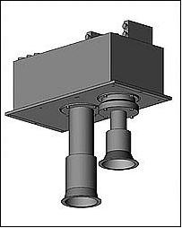
All Resurs-P satellites host the same primary payload of Geoton-L1 (Panchromatic and Multispectral Radiometer - L1), ShMSA (Medium Resolution Wide Capture Multispectral Optical Sensor), and GSA (Hyperspectral Imaging Equipment).
Geoton-L1 is an optoelectronic pushbroom imaging instrument which obtains high-resolution panchromatic and multispectral imagery. ShMSA also obtains panchromatic and multispectral imagery but at a lower resolution and over a wider area. The two multispectral imaging instruments are complemented by a hyperspectral imager, GSA, which obtains imagery across 216 spectral channels.
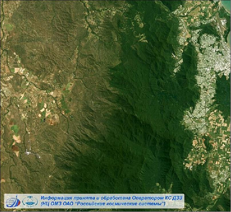
Together, these payloads obtain high-resolution, wide-angle, multispectral and hyperspectral imagery. This imagery is multipurpose, used in state, commercial and research applications, including map making, environmental and agricultural monitoring, hydrology, oil and mineral prospecting, and military purposes.
Performance Specifications
Geoton-L1 obtains imagery across a swath width of 38 km at nadir, with a spatial resolution of 3 - 4 m in multispectral mode and 1 m in panchromatic. ShMSA images over a wider 441.7 km swath, with a spatial resolution of 59 m for panchromatic imagery and 118 m for multispectral imagery. The hyperspectral imagery obtained by GSA has a spatial resolution of 25 m and covers a ground swath (at nadir) of 30 km.
Resurs-P satellites follow a sun-synchronous, near circular orbit. Resurs-P2 assumed a coplanar orbit to Resurs-P1 at an altitude of 475 km and an inclination of 97.3°. The repeat cycle for Resurs-P2 was 3 days with a period of 94 minutes.
Space and Hardware Components
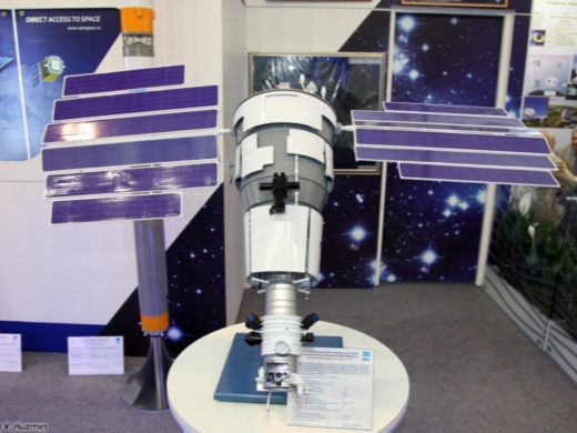
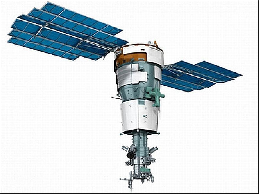
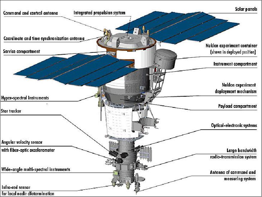
The Resurs-P spacecrafts are based on the Soviet electro-optical reconnaissance Yantar-4KS1 bus design. These spacecraft are three-axis stabilised and approximately 7.9 m in length and 2.7 m in diameter with a launch mass of 6570 kg.
Satellite navigation of Resurs-P is accomplished with star and sun sensors to provide attitude data, and a GLONASS (Global Navigation Satellite System)/Global Positioning System(GPS) system for orbital position determination. The spacecraft design is modular and includes the assembly compartment with the power package module and two photovoltaic solar arrays, the instrumentation bay, and the purpose equipment bay.
Resurs-P (Resurs-Prospective) Remote Sensing Mission Constellation
Spacecraft Launch Mission Status Sensor Complement Resurs-P2 Reusrs-P2 Mission Status Resurs-P3 Reusrs-P3 Mission Status References
Resurs-P1 is a Russian Earth observation satellite designed and developed at TsSKB Progress (Progress State Research and Production Space Center) in Samara, Russia. Roskosmos is funding the project (owner and operator of the spacecraft under the Russian Federal Space Program), the commercial data distributor is Sovzond JSC of Moscow. The spacecraft is operated by NTs OMZ (Research Center for Operational Earth Monitoring), Moscow, Russia.
Resurs-P1 is meant to replace the Resurs-DK, a previous generation spacecraft, which was launched on June 15, 2006. In 2012, the Resource-DK has already gone beyond its design life, and the quality of its pictures has deteriorated, in particular, their resolution has decreased from 1 to 3 m. 1) 2)
In 2015, the Resurs-P constellation consists of two spacecraft, Resurs-P1 and Resurs-P2. Roscosmos plans to launch Resurs-P3 in late 2015.
Spacecraft
The Resurs-P spacecraft series is of military reconnaissance heritage flown in particular during the 1980-90 era. The spacecraft is based on the Yantar-4KS1 bus and is three-axis stabilized. The axis orientation accuracy is 0.2 arcmin, the angular velocity stabilization accuracy is 0.005º/s. The pointing accuracy is < 100 m. Satellite navigation is accomplished with star and sun sensors to provide attitude data and a GLONASS/GPS System for orbital position determination. The spacecraft design is modular, it includes the assembly compartment with the power package module and two photovoltaic solar arrays mounted on the compartment's outer surface, the instrumentation bay and the purpose equipment bay. The design life is 5 years.
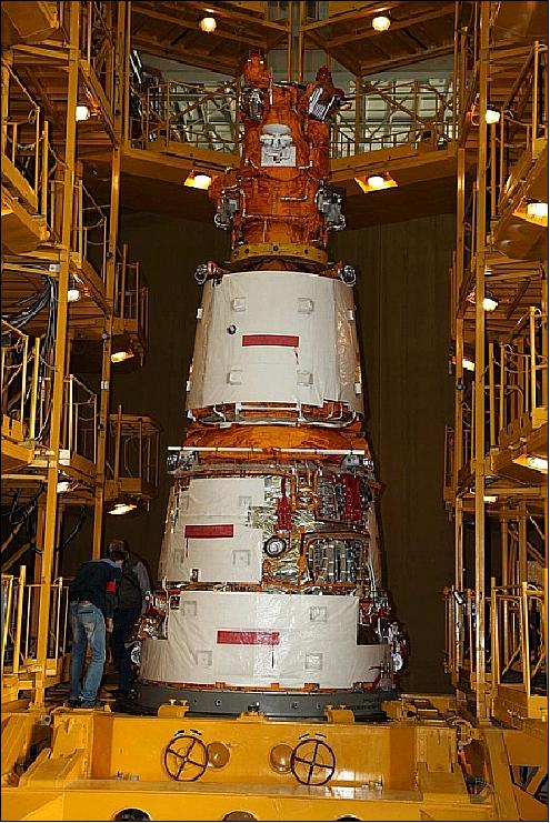
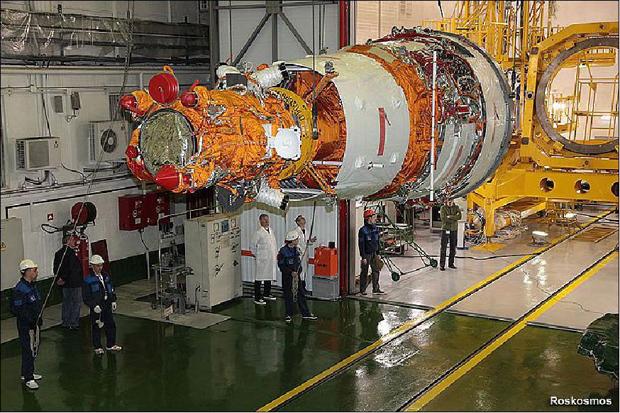
The Resurs-P1 spacecraft is ~7.9 m long and 2.7 m in diameter with a launch mass of 6570 kg and a design life of 5 years . The satellite consists of three sections, a payload section containing the imaging payload, a service section consisting of avionics, electrical systems and other support equipment, and a propulsion section that facilitates the main propulsion system and a high-fidelity attitude control system (Ref. 3).
The instrument module has a length of about 1 m and contains all support systems of the satellite including electrical systems, batteries, navigation equipment featuring a gyroscope unit and two Star Trackers, the vehicle's communication system for command uplink and telemetry downlink and the attitude control system of the spacecraft. Attitude determination is provided by an IMU (Inertial Measurement Unit), Earth sensors and Star Trackers. The three-axis stabilized satellite achieves a pointing accuracy of 0.2 arcmin with a stabilization of 0.005º/s.
Launch
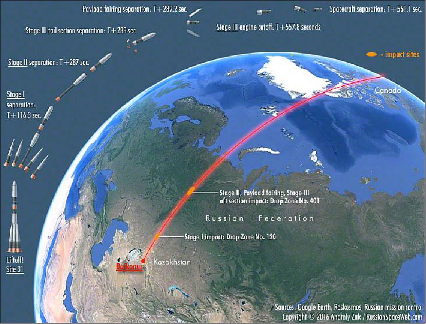
The Resurs-P 1 spacecraft was launched on June 25, 2013 on a Soyuz-2-1b vehicle from the Baikonur Cosmodrome, Kazakhstan. 3)
Orbit: Sun-synchronous near circular orbit, altitude = 475 km, inclination = 97.3º. The repeat cycle is 3 days. LTDN (Local Time on Descending Node) = 10:30 hours, period = 94 minutes.
Mission Status
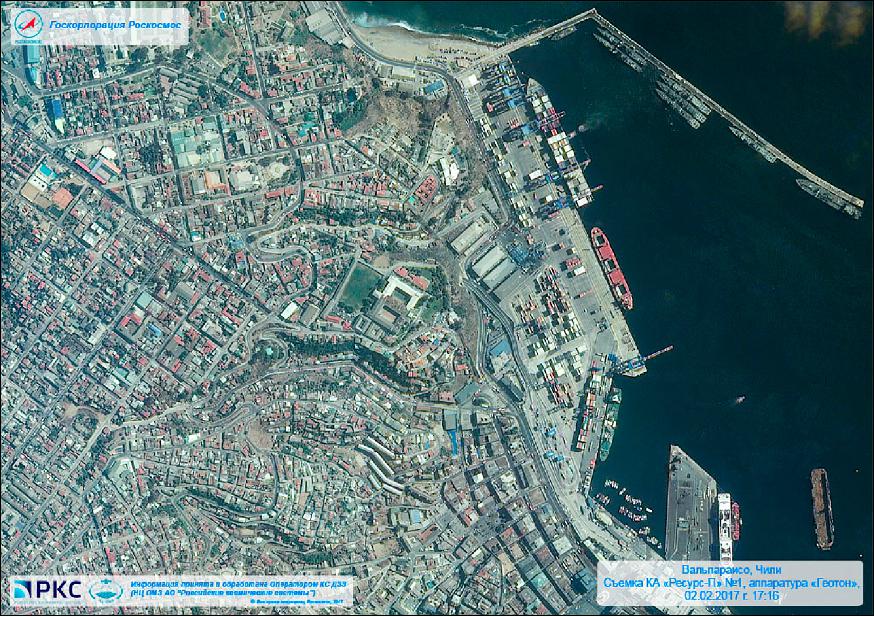
• February 3, 2017: The Resurs-P1 spacecraft and its payload are operational in early 2017. 4)
• According to WMO, the Resurs-P1 satellite is operational in 2016. 5)
• The Resurs-P1 spacecraft and its payload are operational in May 2015. 6)
• The Resurs-P1 spacecraft and its payload are operational in August 2013. 7)
Sensor Complement
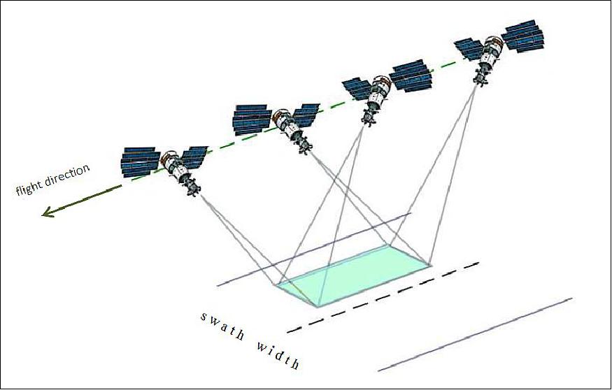
Resurs-P was designed to carry three types of remote-sensing payloads for high-resolution, wide-angle and multi-spectral observations of the Earth surface. As a result, the spacecraft can observe individual targets on the Earth surface, as well as long stretches of Earth's surface extending up to 2,000 km.
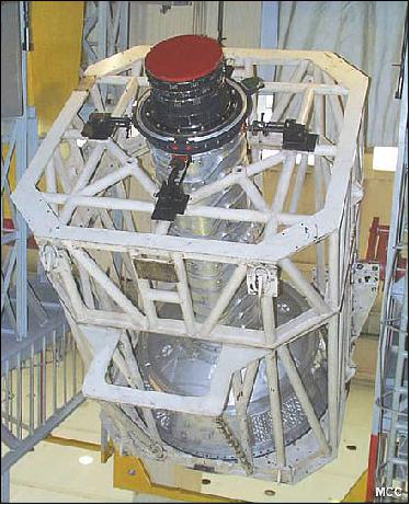
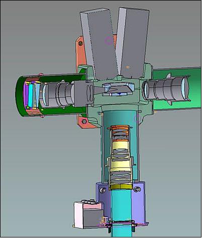
Geoton-L1 Imager
As its main imaging instrument, Resurs-P1 employs the Geoton-1 imager, developed at OAO Krasnogorsky Zavod with an image storing and conversion system dubbed Sangur-1U, developed at NPO Opteks, a branch of TsSKB Progress in Samara. Sangur-1U converts optical images into digital signals, and then processes, compresses and transmits this data to the satellite's radio system for downlink to ground stations. 8)
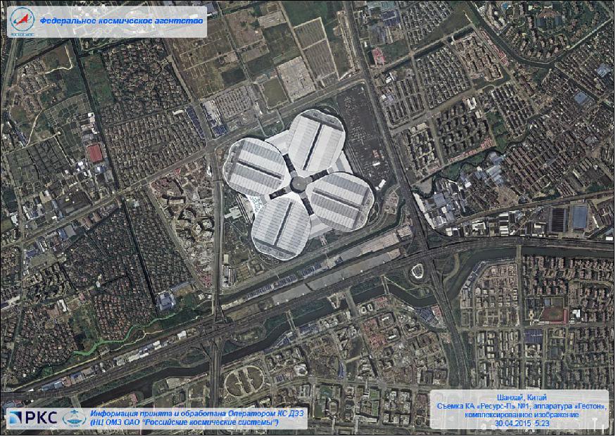
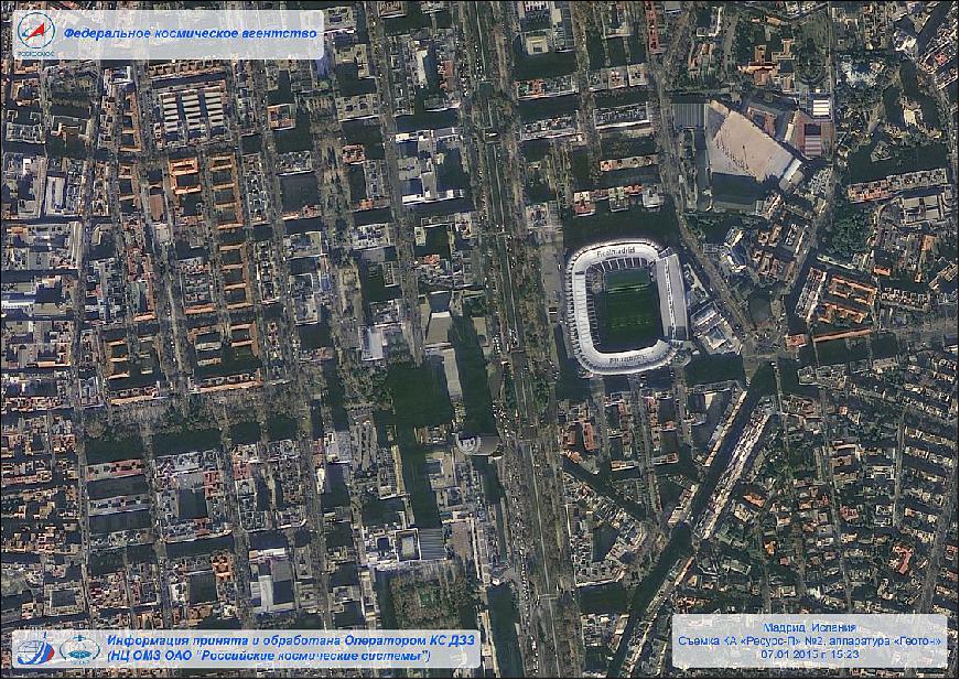
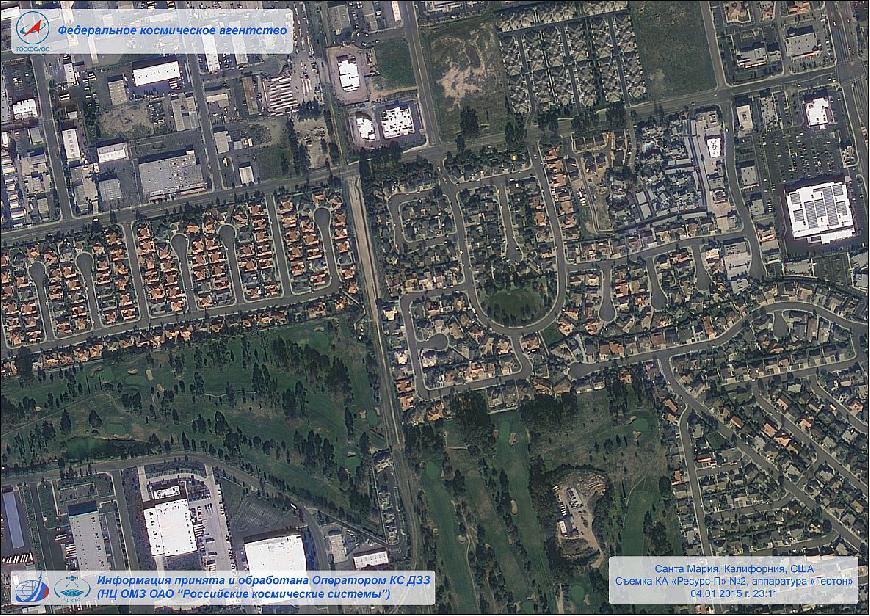
Geoton-1 (also referred to as Geoton-L1) is an optoelectronic pushbroom imaging instrument. The overall objective is to obtain high-resolution imagery of the Earth's surface for commercial and research applications. The instrument provides panchromatic and multispectral imagery in a total of 8 bands in the VNIR spectral range. A survey observation mode provides image scenes of up to 2000 km (along-track). The instrument can be tilted in the cross-track direction for an improved FOR (Field of Regard), this is being done by spacecraft body-pointing (± 30º). 9) 10)
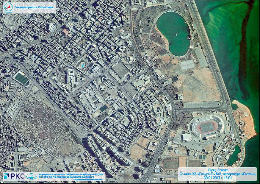
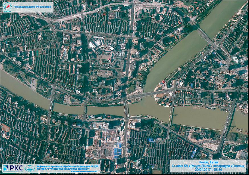
The objective of Resurs-P1 is to acquire panchromatic imagery with a GSD (Ground Sample Distance) of 1 m and multispectral imagery with a resolutions of 3-4 m. Seven spectral channels are supported by the multispectral payload. Resurs-P1 covers a maximum FOR (Field of Regard) of 950 km. Stereo imaging can be obtained since the spacecraft can also be pointed into the along-track direction.
The optical subsystem of the Geoton-L1 imager has a focal length of 400 cm and an aperture diameter of 50 cm. The FPA (Focal Plane Assembly) features 4 TDI (Time Delay and Integration) detector arrays, one panchromatic and three multispectral. Each detector array is composed of 36 "Kruiz" photosensitive CCD chips (also referred to as PhCCD). Effective length of the single array is about 36000 pixels. The Kruiz CCD is a 1024 pixel x 128 line, high speed TDI sensor. The active imaging area is organized as 1024 vertical columns and 128 horizontal TDI rows. The pixel size is 9 µm x 9 µm.
• The number of TDI stages electronically selectable is: 128, 64, 32, 16, 8
• There are two readout shift registers and two output amplifiers allowing a twice faster readout
• Dynamic range: 2500
• Maximum quantum efficiency: 0.33 (at 0.72 µm).
The instrument has a mass of 310 kg; it was designed jointly by NPO Opteks and CNII Electron and manufactured by CNII Electron, Russia.
Parameter | Value | Parameter | Value |
PAN (panchromatic) band | 0.62 - 0.79 µm | Spatial resolution (PAN) | 1 m GSD (Ground Sample Distance) |
MS (Multispectral) bands | 0.48- 0.53 µm (blue) | Spatial resolution (MS) | 3-4 m |
Downlink data rates | 75, 150 or 300 Mbit/s | Storage capacity | 768 Gbit |
Swath width | 38 km at nadir (FOV = 5º 18') | FOR (Field of Regard) | 950 km |
Data quantization | 10 bit | Position accuracy | < 100 m |
The imagery is stored in the onboard memory of the spacecraft for downlink to Russian ground stations via a 300 Mbit/s high-rate communications system.
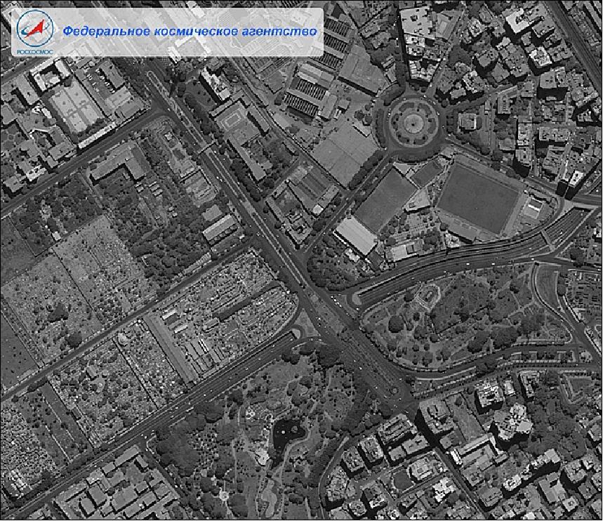
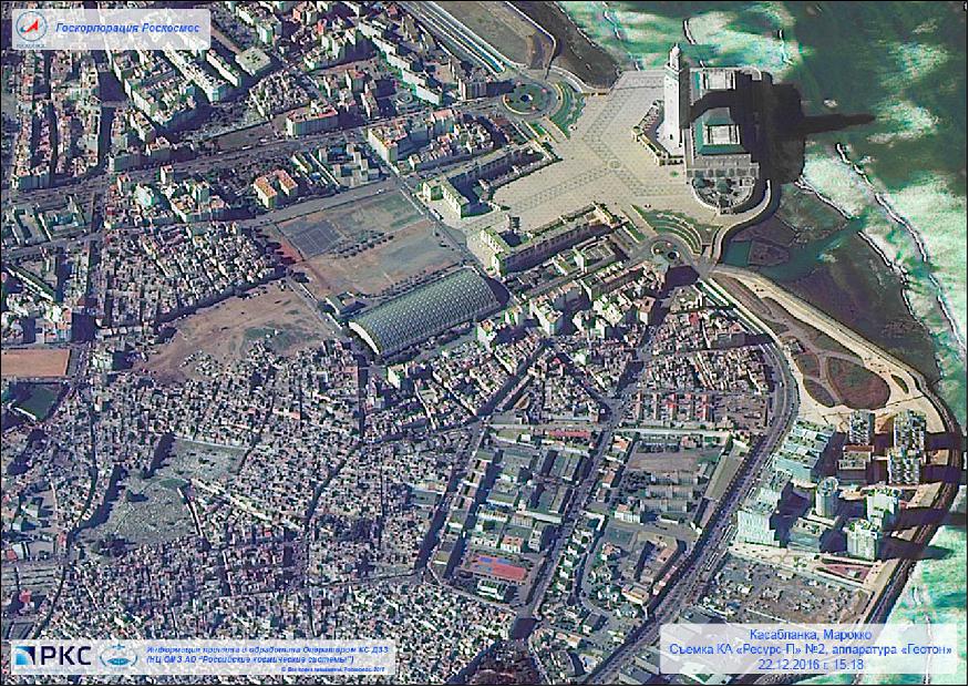
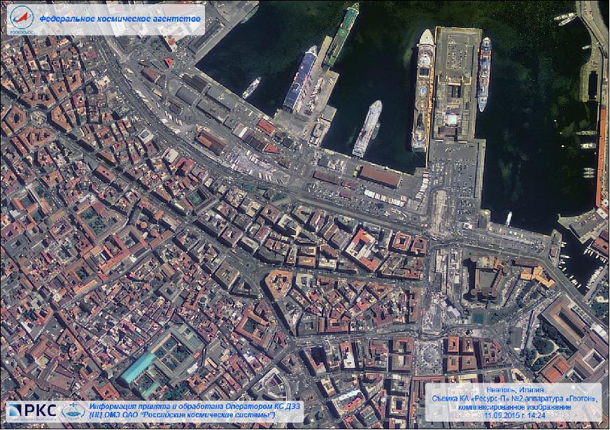
Resurs-P1 imagery users include the Russian government's ministries responsible for agriculture, the environment, emergency situations, fisheries, meteorology and cartography.
GSA hyperspectral imager
The GSA hyperspectral imager can observe 216 spectral channels covering 400-1100 nm at a ground resolution of 25 m. Imagery delivered by the instrument has a spectral resolution of 5-10 nm and the instrument covers a ground swath of 30 km.
Spectral range | 0.4-1.1 µm |
GSD (Ground Sample Distance) | 25-30 m |
Swath width (at nadir) | 30 km |
Number of bands | more than 96 |
Spectral resolution | 5-10 nm |
ShMSA multispectral spectrometer
ShMSA has a 4 cm focal length covering a wide swath of 441.7 km. Both imagers use identical detectors with 8160 pixels per line for panchromatic imaging and 4080 pixels per line for multispectral imaging. The two instruments cover identical wavelength channels. The SHMSA instrument creates images at a 59 m ground resolution in panchromatic and 118 m resolution in multispectral mode.
Parameter | Medium resolution | High resolution | |
Optical system | Focal length Aperture | 40 mm | 200 mm |
Swath width | 441.7 km | 97.2 km | |
GSD Ground Sample Distance) | Panchromatic | 59 m | 12 m |
Spectral bands | Panchromatic | 0.43-0.7 µm | |
MS (Multispectral) | 0.43-0.51 µm (blue) | ||
Pixel size | Panchromatic | 5 µm x 5 µm | |
Data quantization | 12 bit | ||
Surveying modes:
1) Route surveying:
Route surveying can be performed with a constant roll and pitch, and with a given azimuth. Deviation of the spacecraft roll and pitch from the nadir possible up to ± 45°, yaw - up to ± 60°. Duration routes from 2 to 300 seconds.
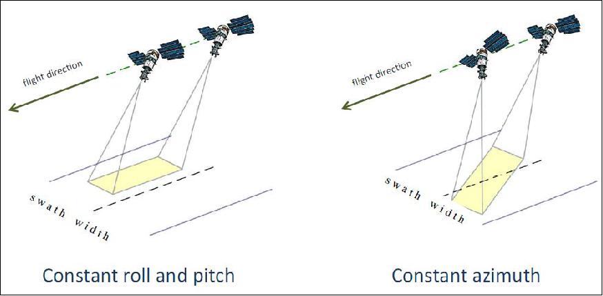
2) Areal surveying:
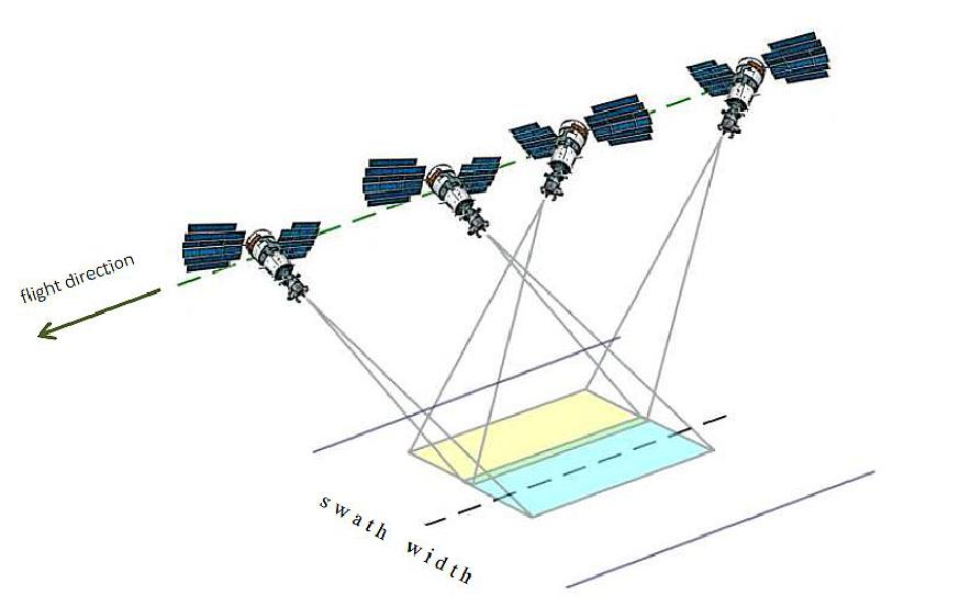
3) Stereo surveying:
Stereo imaging is performed at a single turn with a deviation by the pitch. Length of routes - up to 115 km.
Resurs-P2 Remote Sensing Mission
In parallel with the development of the Resurs-P No 1 remote-sensing satellite, launched in June 2013, TsSKB Progress (later renamed to RKTs Progress) was also working on the second Resurs-P satellite. The spacecraft is nearly an identical copy of its predecessor, Resurs-P1. 12)
Launch
The Resurs-P2 spacecraft was launched on a Soyuz-2-1b vehicle from the Baikonur Cosmodrome in Kazakhstan on December 26, 2014 (18:55:50 UTC). 13)
Orbit: Sun-synchronous near circular orbit, altitude = 475 km, inclination = 97.3º. The repeat cycle is 3 days. LTDN (Local Time on Descending Node) = 10:30 hours, period = 94 minutes. Resurs-P2 assumed a coplanar orbit with Resurs-P1.
Sensor Complement
The sensor complement of Resurs-P2 is a reflight of main payload onboard Resurs-P1 spacecraft.
• In addition, the Resurs-P2 spacecraft carries a high-energy particle detector, which was previously developed for the Koronas-Nuklon satellite (however the Koronas-Nuklon mission was cancelled in 2012).
• A further new instrument on Resurs-P2 is the AIS (Automated Identification System) demonstration device to record the ship traffic in the ground segment.
Mission Status
• The Resurs-P2 spacecraft and its payload are operational in early 2017. 14)
• According to WMO, the Resurs-P2 satellite is operating in 2016. 15)
• The Resurs-P2 spacecraft and its payload are operational in May 2015. 16)
• After launch, Resurs-P2 was tracked in an orbit of 186 by 455 km at an inclination of 97.3º. It was up to the spacecraft to boost itself into its nearly circular operational orbit, a standard practice for spacecraft based on the Yantar bus that hosts its own main propulsion system for frequent and large orbital corrections. These satellites are lofted by Soyuz into elliptical transfer orbits with an apogee close to the operational altitude, leaving the circularization to the satellites themselves (Ref. 13).
Resurs-P3 (Resurs-Prospective No 3)
Resurs-P3 is a Russian Earth observation satellite designed and developed at TsSKB Progress (Progress State Research and Production Space Center) in Samara, Russia. Roskosmos is funding the project (owner and operator of the spacecraft under the Russian Federal Space Program), the commercial data distributor is Sovzond JSC of Moscow. The spacecraft is operated by (Research Center for Operational Earth Monitoring), Moscow, Russia.
Spacecraft
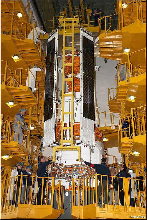
Designed to operate in orbit for at least five years, Resurs-P3 is identical to its older siblings, Resurs-P2 and Resurs-P1, all designed for multi-spectral observation of our planet. The spacecraft has a mass of ~ 5,730 kg. On orbit, the spacecraft can be tilted up to ±45º from nadir for event monitoring. The spacecraft is about 7.93 m in length and 2.72 m in diameter featuring two 5 m long solar arrays for power generation. Each of the deployable arrays consists of several long segments creating a diameter of 4.5 m.
Like its predecessors, Resurs-P3 also carries an image storing and conversion system dubbed Sangur-1U developed at NPP Opteks, a branch of TsSKB Progress in Samara. Sangur-1U converts optical images into digital signal and then processes, compresses and transmits this data to the satellite's X-band radio system for a downlink to ground stations.
Resurs-P3 consists of three sections: a payload section containing the imaging systems; a service section consisting of avionics, electrical systems, and other support equipment; and a section that facilitates the main propulsion system and the high-fidelity attitude control system. The spacecraft's design is modular. It includes the assembly compartment with the power package module and two photovoltaic solar arrays mounted on the compartment's outer surface, the instrumentation bay, and the purpose equipment bay.
Launch
The Resurs-P3 spacecraft was launched on March 13, 2016 (18:56:00 UTC) on a Soyuz-2-1b vehicle from the Baikonur Cosmodrome, Kazakhstan. 17)
Orbit: Sun-synchronous near circular orbit of 475 km, inclination of 97.3º. The repeat cycle is 3 days. LTDN (Local Time on Descending Node) = 10:30 hours, period = 94 minutes.
Resurs-P No.3 started out in an orbit of 274 by 460 km and, per the typical sequence for Yantar-based satellites, was to perform a pair of engine burns on orbits 37 and 69 to enter its nearly circular operational orbit.
Sensor Complement: (Geoton-L1, GSA, ShMSA)
The sensor complement of Resurs-P3 is a reflight of main payload onboard Resurs-P1 spacecraft.
Mission Status
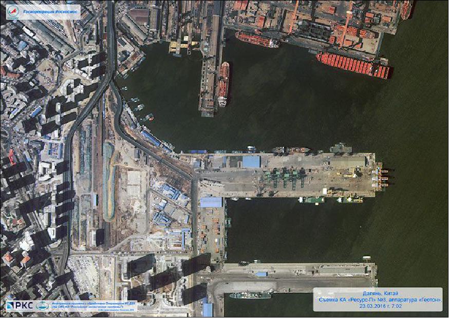
• February 2, 2017: The Resurs-P No 3 spacecraft and its payloads are operating nominally in early 2017. 18)
• Flying out of ground station coverage, the satellite had pressurized its propulsion system and unlocked both power-generating solar arrays for deployment. Mission Engineers expected everything to be nominal when the satellite re-appeared over ground stations, but telemetry sent from the spacecraft showed that one of the solar arrays failed to lock in place. 19)
References
1) Olga Zakutnyaya, "How many Russian Earth observation satellites will be in orbit by 2015?," Space Daily, Nov. 20, 2012, URL: http://www.spacedaily.com/reports/How_many_Russian_Earth_observation-satellites_will_be_in_orbit_by_2015_999.html
2) http://www.orbiter-forum.com/showthread.php?t=31540
3) "Soyuz successfully boosts Resurs P1 Earth Observation Satellite to Orbit," Spaceflight 101, June 25, 2013, URL: http://www.spaceflight101.com/soyuz-2-1b-resurs-p1-launch-updates.html
4) "Images from RESURS-P 1 Spacecraft," NTs OMZ (Research Center for Earth Operative Monitoring), February 3, 2017, URL: http://eng.ntsomz.ru/news/news_center/resurs-p_images_gallery_201702
5) http://www.wmo-sat.info/oscar/satellites/view/452
6) "Images from Resurs-P1 Spacecraft (May 2015), May 14, 2015 , Roscosmos (Russian Federal Space Agency), NTs OMZ (Research Center for Earth Operative Monitoring), URL: http://eng.ntsomz.ru/news/news_center/resurs-p_images_gallery_201505
7) http://eng.ntsomz.ru/news/news_center/resurs-p_images_gallery_201308
8) Anatoly Zak, "Resurs-P Satellite," June 30, 2013, URL: http://www.russianspaceweb.com/resurs_p.html
9) M. Elderdova, "Applications of high resolution satellite imagery acquired from Russian satellite Resurs-DK1," 4th International Conference on 'Recent Problems in Geodesy and Related Fields with International Importance,' Sofia Bulgaria, Feb. 28 - March 2, 2007
10) G. I. Vishnevsky, M. G. Vidrevitch, V. G. Kossov, O: P. Kourova, M. V. Chetvergov, "Unpacked TDI PhCCD designed for large format optoelectronic systems for the Earth remote sensing," Proceedings of SPIE, 'Smart Imagers and Their Application,' Alexander L. Stempkovsky, Victor A. Shilin, Editors, 594409, Vol. 5944, Dec. 6, 2006
11) A. Peshkun, "Resurs-P capabilities and standard products," The 14th International Scientific and Technical Conference, 'From imagery to map digital photogrammetric technologies,' China, Oct. 20-22, 2014, URL: http://conf.racurs.ru/images/presentations/Peshkun.ppsx
12) Anatoly Zak, "Resurs-P2 bolsters Russia's remote-sensing constellation," URL: http://www.russianspaceweb.com/resurs_p2.html
13) Patrick Blau, "Soyuz 2-1B - Resurs-P #2 Launch Updates," Spaceflight 101, January 7, 2015, URL: http://www.spaceflight101.com/soyuz-2-1b---resurs-p-2-launch-updates.html
14) "Images of the Resurs-P No 2 spacecraft," January 31, 2017, NTs OMZ (Research Center for Earth Operative Monitoring), URL: http://eng.ntsomz.ru/news/news_center/resurs-p2_images_gallery_201701
15) http://www.wmo-sat.info/oscar/satellites/view/558
16) "Images from Resurs-P2 Spacecraft (May 2015), May 15, 2015 , Roscosmos (Russian Federal Space Agency), NTs OMZ (Research Center for Earth Operative Monitoring), URL: http://eng.ntsomz.ru/news/news_center/resurs-p2_images_gallery_201505
17) "Soyuz delivers Resurs-P3," Anatoly Zak, March 2016, URL: http://www.russianspaceweb.com/resurs-p3.html
18) "Images from the Resurs-P No 3 spacecraft," NTs OMZ (Research Center for Earth Operative Monitoring), February 2, 2017, URL: http://eng.ntsomz.ru/news/news_center/resurs-p3_images_gallery_201701
19) "Resurs Earth Observation Satellite climbs to operational Orbit, delivers first Photos," Spaceflight 101, March 30, 2016, URL: http://spaceflight101.com/soyuz-resurs-p3/resurs-p3-first-images/
The information compiled and edited in this article was provided by Herbert J. Kramer from his documentation of: "Observation of the Earth and Its Environment: Survey of Missions and Sensors" (Springer Verlag) as well as many other sources after the publication of the 4th edition in 2002. - Comments and corrections to this article are always welcome for further updates (eoportal@symbios.space).
Spacecraft Launch Mission Status Sensor Complement Resurs-P2 Reusrs-P2 Mission Status Resurs-P3 Reusrs-P3 Mission Status References Back to Top