SpaceEye-T
EO
Ocean
Multi-purpose imagery (ocean)
High resolution optical imagers
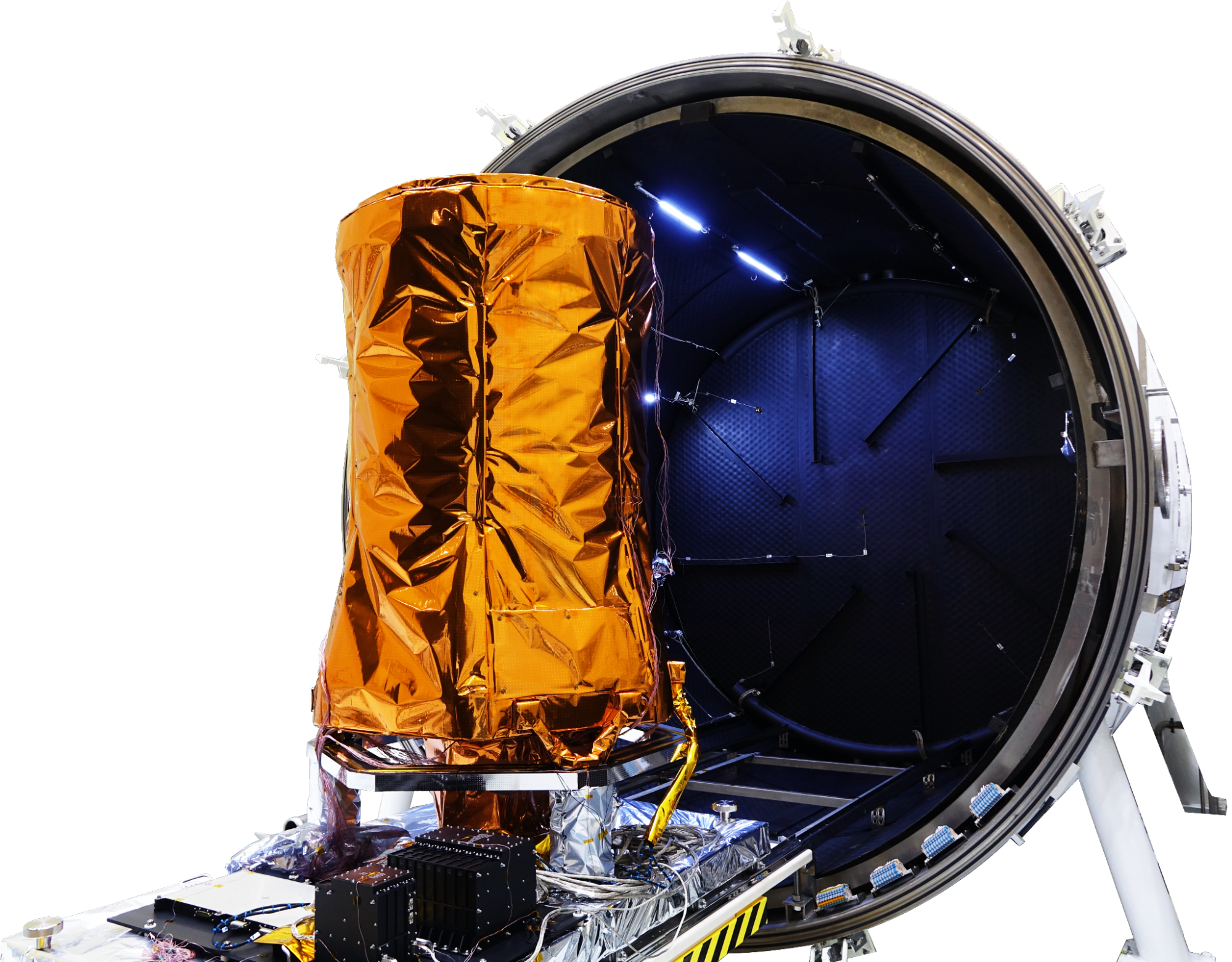
SpaceEye-T, launched in March 2025, is a commercial high resolution imaging satellite owned and operated by the Korean satellite manufacturer Satrec Initiative (SI). SpaceEye-T forms the first component of SI’s plan to create a privately owned constellation of high resolution imaging satellites.
Quick facts
Overview
| Mission type | EO |
| Agency | Satrec Initiative |
| Mission status | Operational (nominal) |
| Launch date | 15 Mar 2025 |
| Measurement domain | Ocean, Land |
| Measurement category | Multi-purpose imagery (ocean), Multi-purpose imagery (land) |
| Measurement detailed | Land surface imagery, Visibility |
| Instruments | High Resolution Optical Sensor |
| Instrument type | High resolution optical imagers, Communications, Data collection |

Summary
Mission Capabilities
SpaceEye-T carries a single instrument, an electro-optical imager designed and developed by SI, known as EOS-T. The instrument is the latest in a series of very-high resolution optical imaging instruments produced by SI.
Performance Specifications
EOS-T images in five bands, one panchromatic as well as four multispectral, and will provide a spatial resolution of 0.25 m in its panchromatic band and 1 m in its multispectral bands, with a swath width of 12 km. SpaceEye-T have an orbit altitude of 500 km.
Space and Hardware Components
The SpaceEye-T satellite platform have a mass of approximately 700 kg. Its ground segment is managed by two SI affiliates, Satrec Initiative Imaging Services (SIIS) and Satrec Initiative Analytics, who commercialise SpaceEye-T data and products, as well as operating the satellite.
Overview
Satrec Initiative (SI) of Daejeon, South Korea, a satellite maker under South Korea’s Hanwha Group, has launched its high-resolution imaging satellite SpaceEye-T into low Earth orbit, marking the first step toward building its own constellation of Earth observation satellites. SpaceEye-T was successfully launched on a SpaceX Falcon 9 transport mission in March 2025 and is now operating in orbit. 1)
The company unveiled the plan on August 18, 2021 saying SpaceEye-T will present its technological capabilities to potential civilian and military customers at home and abroad amid increasing demand for satellite-based Earth observation data.


The 700 kg satellite is designed to offer a GSD (Ground Sample Distance) of 25 cm, with a swath width of 12 km, according to a news release.
“We see an increasing demand for satellite-based Earth observation data, particularly in the fields of energy, climate monitoring, disaster management, and reconnaissance and surveillance for military purposes,” Jeon Bong-ki, a Satrec Initiative executive, told SpaceNews. “SpaceEye-T will pave the way for the company to enter these increasingly lucrative markets.”
He noted that the launch of SpaceEye-T would mark the beginning of the company’s journey toward building its own constellation of Earth observation satellites, but didn’t elaborate further.
He said while Satrec Initiative is responsible for developing SpaceEye-T, its two affiliates — SIIS (SI Imaging Services) and SIA (SI Analytics) — will be committed to operating the satellite and commercialising its collected data.
Satrec Initiative is South Korea satellite maker founded in 1999 by the engineers who developed the first Korean satellite (KITSAT-1) at KAIST Satellite Technology Research Center. It became an affiliate of South Korea’s conglomerate Hanwha Group in January after the group’s defence business arm, Hanwha Aerospace, purchased a 30% stake in Satrec Initiative for about $100 million.
SpaceEye-T is planned to have a mission lifetime of five years, with the potential to extend this to seven years. 1) 2) 7)
Spacecraft
The SpaceEye-T mission is expected to utilise a relatively small satellite bus, weighing approximately 650 kg. The bus design reflects the increasing miniaturisation of the existing bus design used in the SpaceEye-1 mission, and has improved agility and geolocation accuracy. Spacecraft agility has been improved by a factor of two, through the introduction of high-torque reaction wheels, allowing manoeuvre capability of 15.4 seconds from 200 km ground retargeting and ±45° roll, ±30° pitch tilting capabilities. Geolocation accuracy has also been improved by a factor three, through the use of enhanced attitude sensors and control algorithms. The SpaceEye-T bus has an image transmission rate of 1.6 Gbps, with dual polarisation. 1) 4)
The spacecraft's power subsystem is designed to support continuous operations through a combination of deployable triple-junction gallium arsenide solar arrays paired with high-capacity lithium-ion batteries. This configuration delivers a peak power output of approximately 1200 W, ensuring sufficient energy during both sunlight and eclipse phases. The power management and distribution system includes Maximum Power Point Tracking (MPPT) regulators to optimize solar array efficiency under varying illumination conditions.
Thermal control is achieved using a combination of passive and active methods. Multi-layer insulation (MLI) blankets cover the spacecraft to reduce heat loss, while heat pipes and thermostatically controlled heaters maintain the internal environment within operational temperature ranges for avionics and sensitive equipment. The thermal design is validated through detailed thermal balance testing to ensure performance under the expected orbital thermal cycles.
The command and data handling (C&DH) subsystem employs a radiation-hardened onboard computer architecture featuring redundant processing units for fault tolerance. It manages spacecraft telemetry, telecommands, and data storage, supporting up to 256 GB of solid-state memory for buffering high-rate image data before downlink.
The propulsion subsystem on SpaceEye-T uses a monopropellant hydrazine system designed for orbit maintenance and fine manoeuvring, supporting a delta-V budget of approximately 120 m/s over the mission lifetime. The system includes redundant thrusters arranged for 3-axis control to assist reaction wheel desaturation and maintain precise pointing. Radiation shielding incorporates aluminum and composite materials around critical electronics to mitigate effects from the low Earth orbit (LEO) radiation environment, with a focus on Single Event Upset (SEU) resilience and total ionizing dose (TID) mitigation, enabling extended mission duration beyond 5 years. 9) 10)
Launch Mass | ~650 kg |
|---|---|
Power System | Deployable GaAs solar arrays (~1200 W peak), Li-ion batteries |
Attitude Control | 3-axis ADCS with, 4 high-torque reaction wheels, enhanced star trackers and gyros |
Pointing Accuracy | Improved geolocation by 3x (sub-meter level), ±45° roll, ±30° pitch; retargeting in 15.4 s |
Data Transmission Rate | 1.6 Gbps Ka-band downlink, S-band uplink/downlink redundancy |
Onboard Data Storage | 256 GB solid-state memory |
Propulsion | Monopropellant hydrazine, delta-V ~120 m/s |
Thermal Control | Passive radiators and active heaters, heat pipes, thermostatic heaters |
Radiation Protection | Aluminum/composite shielding for SEU and TID mitigation |
Mission Lifetime | ~5 years |
Orbit | Sun-synchronous LEO (~510 km altitude) |

Launch
SpaceEye-T was launched on March 15, 2025 at 06:43 UTC from SLC-4E at Vandenberg Space Force Base in California, aboard SpaceX’s Transporter-13 Rideshare Mission.

Orbit
SpaceEye-T operates in Sun-synchronous orbit, at an altitude of approximately 510 km, with an inclination of 97.4 °, and a period of 94.7 minutes.
Mission Status
September 2, 2025: South Korean provider SI Imaging Services has signed a multi-million-euro, multi-year contract with a European customer to lease dedicated tasking capacity on its newly launched SpaceEye-T optical satellite, which offers 25 cm native resolution imagery. Under this Satellite-as-a-Service (Sat-aaS) agreement, the customer will receive exclusive access to SpaceEye-T tasking and near-real-time image data without owning the satellite, highlighting growing international interest in the Sat-aaS model and SpaceEye-T’s competitiveness in the high-resolution commercial Earth observation market. 12) 13)
- March 15, 2025: SpaceX launched the Transporter-13 Rideshare Mission, carrying more than 60 payloads, including South Korea Satrec Initiative’s SpaceEye-T. The Falcon 9 rocket lifted off at 06:43 UTC from SLC-4E at Vandenberg Space Force Base in California. 8)
- January 14, 2021: Hanwha Aerospace, South Korea’s largest defence company, announced plans Jan. 14 to invest approximately $100 million to purchase 30% of the shares of satellite manufacturer Satrec Initiative.
- August 18, 2021: Satrec Initiative announced its high-resolution SpaceEye-T mission, planned for launch in early 2024 5)
Sensor Complement
SpaceEye-T carries SI’s electro-optical imaging instrument, EOS-T. The instrument images in five bands, one panchromatic band and four multispectral bands. EOS-T provides a spatial resolution of 0.25 m in its panchromatic band, and a spatial resolution of 1 m in its multispectral bands at nadir, with a swath width of 12 km at an orbit altitude of 500 km. SpaceEye-T operates in five different imaging modes, strip imaging operations, multiple strip imaging operations, single pass multi-stereo imaging operations, single pass wide area imaging operations and arbitrary inclined strip imaging operations. These advanced operations are enabled by enhanced spacecraft agility and geolocation accuracy. 3)
In addition to its nominal spectral bands, EOS-T is designed to output imagery in high radiometric precision using 12-bit quantization, improving contrast and signal fidelity across both panchromatic and multispectral data products. This increased radiometric resolution aids analytical tasks such as change detection and classification.
The EOS-T instrument employs a pushbroom imaging architecture with time-delay integration (TDI) technology, common in high-resolution EO sensors, which increases its signal-to-noise performance during fast orbital passes. This sensor suite supports a daily collection capacity of up to approximately 300,000 km² of Earth’s surface under normal operational conditions, enabling extensive coverage for large-area monitoring tasks. The sensor electronics and optical train are calibrated both pre-launch and in-orbit to maintain radiometric and geometric fidelity. Regular onboard calibration routines help correct for detector drift and optical degradation over the mission lifetime. 10) 14)
Instrument Name | EOS-T Electro-Optical Imager |
|---|---|
Spectral Bands | 1 Panchromatic + 4 Multispectral (R, G, B, NIR) |
Panchromatic Spatial Resolution | 0.25 m @ nadir |
Multispectral Spatial Resolution | 1.0 m @ nadir |
Swath Width | 12 km @ 500 km altitude |
Radiometric Resolution | 12-bit quantization output |
Imaging Architecture | Electro-optical pushbroom sensor (with high signal-to-noise with TDI capability) |
Daily Collection Capability | ~275,000–300,000 km²/day |
Product Types | SEN, PRJ, ORT with RPC, world, and metadata files |
Delivery Formats | GeoTIFF, JPEG2000, PNG previews, structured DIMAP v2 folders |
Radiometric Product Options | Basic, Reflectance (with atmospheric and sensor correction) |
Pan-Sharpening | PAN + MS or bundled (user selectable) |
Tasking Priorities | Standard and expedited tasking options |
EOS-T supports multiple standardized product types and customizable delivery formats, enabling users to select imagery that’s tailored to specific analytical or operational workflows. Customers can order Geometry-corrected (SEN), Orthorectified (ORT), or Projected (PRJ) imagery products depending on application needs, with associated metadata such as Rational Polynomial Coefficients (RPCs) provided to support precise geolocation processing. SpaceEye-T imagery products are offered with selectable radiometric correction levels, including Basic and Reflectance-normalized products. Reflectance products include systematic corrections for atmospheric influence and sensor characteristics, enabling consistent surface reflectance analysis across different acquisition times. Imagery is delivered in widely supported formats such as GeoTIFF and JPEG2000 alongside auxiliary files (e.g., world files, metadata XML) to ensure compatibility with major GIS and remote-sensing software tools . A choice of bands or bundled combinations, including panchromatic + multispectral or pan-sharpened products, gives users flexibility in how they integrate SpaceEye-T data into analysis workflows.
While SpaceEye-T’s primary imaging complement is electro-optical, the system’s processing infrastructure can produce both pan-sharpened multispectral products and single-band outputs, supporting use cases ranging from detailed urban mapping to vegetation analysis. This versatility enhances the utility of the imagery across sectors such as environmental monitoring, urban planning, infrastructure assessment, and disaster response. The EOS-T instrument also underpins multiple operational tasking priorities available to users, including expedited tasking with guaranteed priority windows, a feature designed to support time-sensitive imaging requirements such as natural disaster monitoring or dynamic event tracking. 10) 14)
Ground Segment
The SpaceEye-T ground segment is directly managed by its two affiliate companies, Satrec Initiative Imaging Services (SIIS), which is also the exclusive data provider for the Korean Multipurpose Satellite (KOMPSAT) series, and Satrec Initiative Analysis (SIA), which provides AI-native geospatial intelligence solutions for satellite imagery. These affiliates operate the satellite and will be charged with commercialising its data and products. 2) 6)
The ground segment infrastructure includes multiple globally distributed ground stations equipped with high-bandwidth Ka-band high-gain antenna systems, enabling rapid downlink of the satellite’s high-resolution imagery at data rates up to 1.6 Gbps. These Ka-band links use adaptive modulation techniques to maintain link reliability under varying atmospheric conditions. Communication is augmented by an S-band transceiver providing telemetry and command uplink/downlink redundancy, ensuring reliable satellite control and data integrity.
A centralized mission operations center (MOC) located in South Korea oversees satellite health, command and control, and scheduling of imaging tasking requests. The MOC integrates automated scheduling software capable of optimizing satellite tasking to meet priority requests and maximize daily collection capacity. Data processing pipelines at the SIIS ground segment leverage cloud-based architecture and high-performance computing clusters to perform real-time radiometric and geometric corrections, orthorectification, and product generation. This allows delivery of ready-to-use imagery products within hours of acquisition. SIA complements the ground segment by applying AI-driven analytics and machine learning models on the processed imagery to extract actionable insights for customers, including object detection, change monitoring, and predictive analytics tailored to various commercial and governmental use cases.
The ground segment also supports a web-based user interface and API access, providing customers with tasking request submission, imagery preview, download services, and analytics tools within a unified platform. This digital ecosystem enhances user experience and broadens market reach. 10) 14) 15) 16)

References
1) “SI Imaging Services signs multi-year European contract to lease capacity on SpaceEye-T,” SatNews, https://news.satnews.com/2025/09/02/si-imaging-services-signs-multi-year-european-contract-to-lease-capacity-on-spaceeye-t/, Accessed 15 January 2026.
2) “Ground Systems – 쎄트렉아이.” Satrec Initiative,https://www.satreci.com/sub0103 Accessed 6 March 2023.
3) Lee, Hungu, et al. “Performing Earth Observation Missions Using Micro and Small Satellites.” Asia Pacific International Symposium on Aerospace Technology, 5 December 2019, URL: https://www.satreci.com/sub0404/file_down/id/456
4) “Satellite Systems – 쎄트렉아이.” Satrec Initiative, https://www.satreci.com/sub0101 Accessed 6 March 2023.
5) “Satrec Initiative aims to build world's highest-resolution optical satellite.” The Korea Herald, 18 August 2021, https://www.koreaherald.com/view.php?ud=20210818000790. Accessed 6 March 2023.
6) “South Korea's Satrec Initiative to build constellation of high-resolution Earth observation satellites.” SpaceNews, 18 August 2021, https://spacenews.com/south-koreas-satrec-initiative-to-build-constellation-of-high-resolution-earth-observation-satellites/. Accessed 6 March 2023.
7) “Suppliers » Satrec Initiative.” Skybrokers,https://sky-brokers.com/supplier/satrec-initiative/. Accessed 6 March 2023.
8) Lentz Denny, “SpaceX launches Transporter-13 rideshare from Vandenberg”, NasaSpaceFlight.com, March 14, 2025, URL: https://www.nasaspaceflight.com/2025/03/t13/
9) Gunter’s Space page, “SpaceEye-T”, URL: https://space.skyrocket.de/doc_sdat/spaceeye-t.htm
10) SIIS, “Beyond Boundaries, SpaceEye-T”, Satrec Initiative, URL: https://si-imaging.com/page/21
11) n2yo.com, “SPACEEYE-T1”, URL: https://www.n2yo.com/satellite/?s=63229#google_vignette
12) Werner Debra, “European customer leases SI Imaging Services’ SpaceEye-T”, Space News, September 2, 2025, URL: https://spacenews.com/european-customer-leases-si-imaging-services-spaceeye-t/
13) GIM International, “SI Imaging Services secures contract for 25cm resolution SpaceEye-T imagery”, September 3, 2025, URL: https://www.gim-international.com/content/news/si-imaging-services-secures-contract-for-25cm-resolution-spaceeye-t-imagery
14) SIIS, “Brochure: Beyond Boundaries, SpaceEye-T”, Satrec Initiative, URL: https://www.si-imaging.com/theme/responsive_SIIS/include/img/SpaceEye-T_en.pdf
15) SIIS, “SpaceEye-T - The 25cm VVHR Commercial Satellite Developed by Satrec Initiative Group“, Satrec Initiative, URL: https://www.si-imaging.com/page/21_01_1
16) SIIS, “SI Group”, Satrec Initiative, URL: https://si-imaging.com/page/63